Sunday, June 30, 2013

Part 122 - Eternal Progression

What he doesn’t understand, he has all eternity to learn, and I suspect that as Einstein grows and matures in knowledge and understanding of celestial bodies, how to calculate their weight and mass and position them correctly in relationship to all other objects, the sandbox he gets to practice in will be significantly larger than the one my father wrote about.

To this day, I do not understand fundamental algebra, even though I’ve taken numerous classes in the subject.  I flunked trigonometry in college and calculus is beyond my comprehension, but I have a deep desire to learn.  In fact, I have an overwhelming desire to learn all things mathematical; it’s just that these subjects at the moment are not a high priority for me.

Assuming I’m a slow learner, what if I had a thousand years to learn algebra and another thousand years to learn trigonometry and had, at my disposal, the Universe’s most outstanding instructors to teach me and guide me in the practical application of these disciplines?  

Then what if I took another two thousand years to learn applied calculus and another five thousand years each, to learn quantum physics, axiomatic of Euclidean geometry, binary polyhedral, paradoxes of naïve set theory, probabilistic complexity theory and tauberian theorems.  If I can hike the PCT, I think that given enough time, and with the right teachers, I could learn anything and everything related to mathematics.

We need to remember that eternity is forever, and like the Internet that has no end page, there is no shelf life or expiration date for eternity, and for those who desire, it’s all about the acquisition of knowledge.  Suppose for a moment that my fellow trail hikers – Giggles, Sundog, Storytime, Blast, Nurse Betty, Cookie, Peter Pan, Lucky Man, Purple Haze, Yashinka, and Swiss Army, are with me beyond the veil, and together we’re in the same organic chemistry class that has an upper-level division number of 500,021 – does it matter how long it takes us to master the concepts and laws that govern the molecular structure and process of turning water into wine?  Would five hundred thousand years or 1.5 million years be sufficient for this class project?  After all, the time and capable instructors are available to us and the laws governing the transformation of changing the molecular structure of water to wine is only a mystery because, as mortals, we don’t understand the process.  But others do, and we can learn from them.

I suspect there are few people who give any thought as to what life will be like post-earth life. However, I do think most people believe in a post-earth life, a time of reuniting with family members and loved ones, but what we do after those initial greetings are concluded is the great mystery.  If you think about it, sitting on a cloud and staring at one another for five hundred years, or even five years, will get old real fast.

Life after death is about the acquisition of knowledge, for that’s how we advance in intellect, grow in stature and mature into well-rounded and socially responsible individuals, something much of mankind never had the opportunity to achieve during their time of mortal probation.  This is the time when the Homeless of the world will have the opportunity to fulfill the full measure of their creation.  This is the time when the shackles of mental aberration, physical privation, inherited social and economical deprivation will be unlocked and Homeless, my homeless acquaintance in Independence, California, who spends a great portion of his day leaning against a light pole on Main Street and carries on a conversation with imaginary friends, will be set free. 

To a great extent, we cannot avoid the adversities that life heaps upon us, but if we keep an eternal perspective about life, we wouldn’t want it any other way, for it is in the refiner’s fire that precious metal emerges; our job is to endure it well.


Saturday, June 29, 2013

Part 121 - The King of Eolim

 The King of Eolim – What is Man’s Ultimate Potential
As I walked, in my mind, I began to remember a part of a story my father had written titled "The King of Eolim," which was published in 1975.  The starting point of the story was Earth in the year AD 3300 when space travel was as common as a drive across the country.  To eliminate overpopulation and overcrowding on Earth, colonies had been set up on the multitude of Earth-like planets that had been discovered in the Universe; the youngest colony being three hundred years old, while some of the older ones were more than a thousand years old.

Genetic engineering had produced a highly intelligent human that still looked and functioned much like a human from the year 2014, but with significant differences.  The physical challenges had been relatively easy to conquer- aging had been slowed dramatically, physical deformities were a thing of the past, and human bodies were as perfect as genetic engineering could make them; diseases of all types had been eradicated.

The conquest of the intellect was a harder nut to crack; it would always be a work in progress, but the socially acceptable minimum IQ for survival had to measure at least two hundred on the new IQ scale.  On the old IQ scale, a rating of 140 was on the threshold of genius, but in the current society, such mentally deficient offspring were considered Retards and were disposed of by euthanasia by age twelve at a maximum.

Morten Bradwell was a highly respected and very competent genetic engineer, whose personal mandate was to make humans better than the previous generation.  His sixteen-year-old son, Freeman Bradwell, was a Retard and should have been disposed of years ago, but Morten considered him his son and loved him and refused to put him away.

The part of the story that truly intrigued me was a game father and son played called Universe.  The purpose of the game was to build a universe of galaxies, star clusters, planets, solar systems, and other objects in the space of a game room that measured ninety feet high.  The objects were metallic spheres and particles that were suspended in a specially adapted magnetic field within the confines of the playroom.

Players used high-powered personal computers to calculate the weight and mass of the spherical objects and to pinpoint the precise location or coordinates to place the objects in space and then relied on tractor arms or mechanical levers to place the spheres in the universe according to the coordinates supplied by the computer.  A miscalculation in the weight or mass of the object or the coordinates for placement, in relation to all other objects in the universe, would cause the universe to collapse and fall to the floor; the player causing the collapse was not only the loser, but was then open to ridicule for his/her ineptness.  Playing time could go on for hours.  The father, Morten Bradwell, always used the computer for play, while Freeman, the Retard who had no concept of how the computer worked, played by instinct.  Or, as he would say, “What I do, just feels right.” [2]

That’s the end of the story, as far I want to relate it, but keep in mind the concept that my father had outlined here – the ability to create a Universe in microcosm - one, by using a sophisticated computer; or two, doing so by discerning intuition – “It just feels right.”

One of mankind’s most intellectual and brilliant scientists was Albert Einstein; certainly there were and are many like him in all fields of scientific endeavors, but Einstein is a name that is most recognizable.  He was born in Ulm, Germany, in 1879, and died at age seventy-six in 1955 in Princeton, New Jersey.

Fast forward now to two days after his death.  His mortal body is being prepared for the funeral; relatives and close friends are gathering to pay their respect to a truly great man, but Albert himself is now beyond the veil in the world of spirits.  He’s with his parents and grandparents, aunts and uncles; they recognize him and are happy to see him.

Other than no longer having a corporal body - that will be returned to him later - remember, that’s why we celebrate Easter.  Has Einstein changed?  Just because he’s on the other side of the veil, has he lost his intellect, his thirst for knowledge, his drive to understand the mysteries, the unfathomable and incomprehensible secrets of the Universe?

Is he not still inquisitive; is he not still searching for knowledge and understanding of all that he now sees going on around him in the spirit world?  Einstein is still Einstein; his personality and intellect is still intact but he’s now in a position to be taught by teachers and instructors who comprehend and understand how the Universe was put together.


Friday, June 28, 2013

Part 120 - The Massive Castle Crags

The trail commenced on the other side of the bridge that crossed over the Sacramento River where Martha picked me up two days ago.  It was a mile-and-a-half walk back to this point and I walked the frontage road all the way.  Just as I stepped foot on the trail, a car pulled up beside me and out stepped Cookie and Runs-with-Elk.  They had hitched from Mount Shasta, and were set to continue the trail.

The climb for the day was going to be up the steep face of Castle Crags, a massive granite monolith that formed deep in the earth’s crust eons ago.  Overriding continental plates pushed this column towards the earth’s surface, with the softer rock eventually being eroded away, exposing the crags and spires.  Today, the crags are fully exposed, and ever so slowly, they too are being washed to the sea, grain by grain.  Viewing satellite images of the crags, they appear as a bright, irregularly formed crystal, lying on a mantel of green fabric
.
Getting a late start on today’s hike, coupled with an exhausting, punishing climb up three thousand feet of dusty trail only advanced me a few miles beyond the far western edge of Castle Crags Wilderness area, for a total of twenty-five miles. These were hard miles, and I earned every one of them the old-fashioned way – I worked for them, eight steps at a time.  But the views back along the trail, looking up at the domes, spires, and pinnacles of the crags were stunning, and well worth the effort of the hike.

The trail this day alternated between following ridgelines and/or contours for miles across the steep slopes of the mountainsides.  Getting in late in the evening, I kept looking for a place to set up camp, but the trail was still traversing across the side of the mountain.  Finally, at the corner of a switchback, a sloping flat spot among the rocks appeared, and I took it, but to make the spot level enough to sleep on, I had to place the lower half of my air mattress on top of my backpack.

The night was pleasant; the ambient temperature was warm and the ants were minimal.  I set my internal clock for 3:00 a.m.  I know it's ludicrous; nobody else gets up this early just to hike, but I recognize that I’m different; I’m highly goal-oriented and I wanted to make as many miles as possible tomorrow – I had Etna on my mind.

At three in the morning my eyes popped open and a half hour later, I was on the trail following the beam of my headlamp.  The trail continued to contour around the side of the mountain.  Around five o'clock, it was light enough to see the trail without the use of the headlamp, so I stowed it inside my Camelbak hydration pack.  I had a small snack when I left this morning, but at seven o'clock, I stopped to fix a proper meal for breakfast.  A proper meal was nothing more than hydrated oats with crushed nuts, spices, and powdered milk.  To my chagrin, I fell asleep eating my breakfast, so I pulled my Z-pad off my backpack, laid it on the ground and sacked out for twenty minutes.


This area of the Klamath Mountain range in times past was heavily glaciated, resulting in the formation of numerous lakes; however, the trail has been routed to avoid most of them as they are still frozen and snowbound even into late July.

From the trail, I could see Seven Lakes Basin, and shortly thereafter I passed over a major crest - the Trinity Divide, which diverted surface water either to the Sacramento River to the east or the Trinity River to the west.  In either direction, both rivers entered the Pacific Ocean only 280 miles apart.  [1]

The walk this day was long and the scenery was monotonous, being mostly forested lands, with some areas showing logging activity, so to pass the time as I walked, I let my mind wander.  My memories were my only form of entertainment, for I carried no electronic entertainment center like an iPhone, an iPod, or a shuffle.  


Thursday, June 27, 2013

Part 119 - A Tough Hitch to Castella

It was four thirty in the morning, and I was up and ready for the day.  I packed my backpack last night, and I had my cardboard hitchhiking sign ready for this morning that said Castella, please.  By 5:00 a.m. I was on the street, and of course, there was no traffic.  I walked down the road towards a café to which a number of cars were pulling into.  My hope was that I would have better luck there than in front of my motel. 

 After an hour’s wait, I landed a ride with Brodie whose vehicle was loaded with guitars and other string instruments.  He said he taught guitar, primarily in the San Francisco Bay area, and in his younger years, had been a river guide on the Colorado River.  It’s always a small world.  He let me off at the exit to the Chevron Station/Ammirati’s Market in Castella, and I walked the short distance to the gas station.  I arrived there just as the owner was opening up for the day.

As soon as I was inside the store, I went to the shelving that contained the hikers' packages.  I rummaged through them, but couldn’t find mine.  I made a second pass through the packages, this time using my "woman’s eyes," as my wife likes to call her search for something, and I found it - big relief.

On the other side of the gas station parking lot was a patch of grass and a picnic table.  I walked over to the table to use it for sorting through my resupply box and to repack my backpack.  Forty-five minutes later, I was ready to leave, carrying enough food to see me through to the town of Etna, my next resupply point – one hundred miles and four days away.  At the gas station, I met Veggie, Sundog, Giggles, and Wight, who were also there to pick up their packages.

Another image of the Crags.

The trail will wind its way to the top of the crags and then over a pass.

Sundog and Giggles, a couple who had previously hiked the PCT.


Wednesday, June 26, 2013

Part 118 - The Mysticism of Mt. Shasta

Yashinka is young, only twenty-one years old, and wears his dark, coarse black hair like a 1960s-era Beatle; he never wears a hat, says he doesn’t like them, but does wear a headband to keep the hair out of his eyes.  Across his chest dangling from a shoulder strap is a large digital camera with an oversized lens.  Yashinka is a photographer for a Japanese magazine and is doing a story about the PCT for his publisher.  His English is good, and the bubble of hikers he hikes with have taken a special liking to him.

Today was Tuesday, July 23, 2013, and I decided to stay another day in Mount Shasta.  In talking with my wife, she said that according to the USPS tracking number, the package wouldn’t arrive in Castella until late this afternoon, so I elect to wait and pick up the resupply package tomorrow morning
.
The town of Mount Shasta was not big; within a couple of hours I had walked all the city streets.  I like to window-shop, you know, just browse the storefront windows, to see what was going on inside the establishment, to see what the owners were selling.  I found a bookstore and spent a lot of time going up and down the aisles, sampling books on history, books on computers, and books about people – bookstores are my favorite places to hang out.

There were hikers in town; most I didn’t recognize, but their clothes and beards, if they were men, gave their identity away.  I saw one young man loaded down with a large pack searching the streets for something, and on top of his pack was a full-grown cat secured to the pack with a chest harness and leash.  I loved it.

The town of Mount Shasta is definitely unique and the best word to describe this uniqueness would be the word "mysticism."  According to the locals, the town has a supernatural aura about it; it’s known, far and wide, as a place of spiritual light, a place where one can come for healing, for spiritual readings, for meditation and reflection.  The town is a magnet for mystics, gurus, and sages, and judging from the number of placards and signs I saw hanging in the windows of homes and business establishments, healing by the use of crystals and other exotic gem stones is a primary activity for many people in town.  Mount Shasta is in the same league as Sedona, Arizona, and Bath, England, three towns renowned for their culture of mysticism.

To understand the distinct flavor of the town, I quote the following article:

Perhaps the most popular example of Mount Shasta lore, and a legend involving the first claim by non-Native Americans for a spiritual connection with the mountain, concerns the mystical brotherhood believed to roam through jeweled corridors deep inside the mountain.  According to Miesse, "In the mid-19th Century paleontologists coined the term "Lemuria" to describe a hypothetical continent, bridging the Indian Ocean, which would have explained the migration of lemurs from Madagascar to India. 

 Lemuria was a continent which submerged and was no longer to be seen.  By the late 19th Century occult theories had developed, mostly through the theosophists, that the people of this lost continent of Lemuria were highly advanced beings.  The location of the folklore 'Lemuria' changed over time to include much of the Pacific Ocean. 

 In the 1880s a Siskiyou County, California, resident named Frederick Spencer Oliver wrote A Dweller on Two Plants, or, the Dividing of the Way which described a secret city inside of Mount Shasta, and in passing mentioned Lemuria. Edgar Lucian Larkin, a writer and astronomer, wrote in 1913 an article in which he reviewed the Oliver book.  In 1925 a writer by the name of Selvius wrote "Descendants of Lemuria: A Description of an Ancient Cult in America" which was published in the Mystic Triangle, Aug., 1925 and which was entirely about the mystic Lemurian village at Mount Shasta. 

 Selvius reported that Larkin had seen the Lemurian village through a telescope.  In 1931 Wisar Spenle Cerve published a widely read book entitled Lemuria: The Lost Continent of the Pacific in which the Selvius material appeared in a slightly elaborated fashion.  The Lemuria-Mount Shasta legend has developed into one of Mount Shasta's most prominent legends" (Origin)

Mount Shasta is a great place I would definitely come back to visit, but next time, it will be on my Honda Gold Wing motorcycle.

Before heading back to my motel room, I made a visit to the major grocery store in town – Ray’s Food Place.  In addition to purchasing snacks and chocolate pudding cups, I also bought a green salad, some tomatoes, and avocados.  I don’t normally do green stuff, but I thought the leafy material would do my body some good.  At the checkout stand, I ran into Cookie, who said she and Runs-with -Elk were camped at the campground just outside of town.  Cookie’s one of those pleasant individuals that is always fun to visit with.  I hadn’t seen her in several hundred miles.


Mount Shasta, home of the mystical Lemurias, dominates the horizon for many, many miles.

Tuesday, June 25, 2013

Part 117 - At the Base of Mt. Shasta


This clip is from a newspaper article of the day that recounts the Marlboro experience:

Against the backdrop of wind-eroded red rocks in the desert outskirts of Moab, Utah, a bus the size of a jet airliner pulls to a stop in a cloud of dust.  Eighteen members of the Marlboro Adventure Team and an entourage of foreign journalists step off the bus.  The journalists are here to cover the company’s month-long, all-expenses-paid outdoors vacation in which four teams of handpicked participants will raft the Colorado River rapids, power their way up sand dunes by Jeep and race across the desert on motorcycles and ATVs in the name of high-powered adrenaline adventure — footage from which will be broadcast overseas in Marlboro ad campaigns and as promotion for the next year’s event.

In response to its rigorous international promotion campaign aimed at young adults, Philip Morris claims to receive nearly one million adventure team applications worldwide for its annual desert event.  After conducting telephone interviews and a boot-camp selection process meant to measure charisma and athletic ability, the cigarette maker whittles its final choices down to 100 men and women aged 18 to 25 — most of them nonsmokers — who come from countries with the highest smoking rates in the world.  (Washington)

By the 1970s, Marlboro was the leading cigarette brand in the world.  As a side note, four of the seven actors or characters who portrayed the iconic Marlboro Man have died from smoking-related diseases; the latest was Eric Lawson – January 2014.

Mount Shasta towered above the town with the same name.  It’s a stratovolcano, meaning its shape has been built up over time by eruptions of slow-moving lava flows down its steep-sided slopes, the last eruption being about a hundred years ago.

With my pack deposited in the room and a bit of daylight still lingering in the sky, I ventured forth into the town to see what I could discover.  Foremost on my short list of to-do items was to find a grocery store and a Laundromat.  I was successful with both items and returned to my room with snacks for later in the evening and to make a quick change into rain gear so I could do laundry at the coin-operated Laundromat just down the street.  On my way back from the Laundromat with clothes that were still damp (I didn’t want to spend the money for the dryer), I met the German couple from Berlin – Biers and Ranch, and the Japanese hiker, Yashinka, who were also staying at the Travel Inn.


Monday, June 24, 2013

Part 116 - The Marlboro Man

 There was a shuttle bus that connected Dunsmuir with Shasta City and would depart in one hour.  Searching around for a place to wait, I found a picnic table next to the police station, and discovered that it had outside electrical outlets; while I waited, I charged my cell phone and finished off a box of cookies while sitting at the table.

Dunsmuir was a quaint little city, neat and orderly without graffiti marring the exterior of the buildings.  It had no streetlights or parking meters and had retained the ambience of a city from the 1920s to 1930s.  It owed its life to the coming of the railroads.  In 1887, the Union Pacific line was completed through the steep Sacramento River Canyon, and a roundhouse and switching yard were built south of town, on Soda Creek Flats, to service steam engines and add additional engines to help push the trains over the steep grades north of town.  Dunsmuir, originally dubbed Poverty Flats or Pusher, was also noted for its world-class, blue-ribbon fishing in the Sacramento River. [1]

The shuttle arrived on time and I climbed aboard, placing my pack in the seat next to me. The fare was two dollars and I was the only passenger aboard.  The driver, who looked a bit like Santa Claus, was friendly and I told him I would like to be let off at the Travel Inn in Shasta.  He said he knew exactly where it was and would do as I requested; the twelve-mile ride to Shasta passed quickly, and within twenty minutes I was standing in front of the Travel Inn in downtown Shasta, my home for the night.

The motel had a 1950s look to it - small courtyard ringed with small apartment-sized units with outside wall-mounted air conditioners.  The front rental unit has been converted to an office and living unit for the manager and his family, which in this case consisted only of a husband and wife.  The motel may be from the fifties, but the nightly rate was more modern. 

The rate for a nonsmoking room, plus tax, was eighty-two dollars, which for my frugal mind-set that is content to sleep outside in the woods, was excessive.  The manager was from India, as are many motel managers I have met in my travels, even as far back as the 1980s when I biked across America.  I asked the manager why he thought members of his ethnicity tended to gravitate towards the hospitality industry.  His English was good, but I couldn’t get a straight answer from him, so I was still left to wonder.

The manager escorted me to my room and opened it for me to validate his claim that it was a nonsmoking room.  I thanked him, walked into the room, and dumped my pack and trekking poles on the floor.  As I stood there in the middle of the tiny room and surveyed my surroundings, I contemplated the term "nonsmoking," and couldn’t help but marvel at what a significant advancement society has made in relation to this fundamental quality of life.

Momentarily, into my mind flooded memories of riding in Greyhound buses when smoking was permitted, of flying in airplanes when smoking was permitted, and attending outfitter meetings in Moab, Utah, and Salmon, Idaho, when smokers, without even a hint of consideration for others, would light up and turn the room blue with cigarette smoke, leaving the nonsmokers gasping for fresh air and rushing to open every available window.  I am so grateful we’ve moved beyond those archaic times.
Marlboro Country it’s not

As a river outfitter in the 1970s through the 1990s, Moab, Utah, was my home base, which was also the location of Canyonlands National Park, Arches National Park, and the Colorado River.  The scenery around Moab is world-class and is the primary attraction for visitors from all over the world, as well as the film industry.

 In every respect, Moab, and its red-rock country symbolizes and embodies the idealism of ruggedness and imagery of the American Old West.  And it was for these attributes that Philip Morris, the makers of Marlboro cigarettes, descended upon Moab, beginning in the 1960s, to use the red rocks of Canyon Country as a backdrop for their new ad campaign.

The idea behind their brilliant marketing campaign was to bring groups of young people to Moab, split them into teams and have them compete in adventure activities such as four-wheeling, canyoneering, rafting the Colorado River, and racing dirt bikes across the desert sands. All the while, the cameras were rolling, and the end product was a fast-paced, exciting adventurous movie clip that was played again and again in theaters in Europe, Asia, and Latin America, where restrictions on cigarette advertising were virtually nonexistent, and always with the subtle and underlying theme; if you smoke Marlboro cigarettes, you too can be a cowboy and live the Old West adventure.

Eric Lawson - iconic Marlboro Man died in 2014 of chronic obstructive pulmonary disease.

I met Veggie on the trail, and he's still wearing the same cotton t-shirt. He's trying to make it last until the border crossing.

Sunday, June 23, 2013

Part 115 - The Burger Barn

I had to cross the bridge that spanned the Sacramento River in order to get to the frontage road that would lead me south to the post office at Castella.  Jumping from the bridge were several young men who were obviously enjoying a day off from work.  I approached them to inquire about directions to Castella, just to verify that the frontage road I was seeking would indeed lead me to Castella and the post office.  I was halfway across the bridge when a small vehicle approached from the other end.  I stepped aside to make room for it, but instead of passing by, it stopped beside me. 

The passenger side window rolled down, and a middle-aged woman spoke from inside the car offering me a ride.  She said she could take me to a trailhead on this side of the river that was more pleasant to walk than walking the frontage road to Castella.  I hesitated, because being somewhat of a purist, I didn’t want to accept a ride and bypass even a small section of the PCT. 

She noted my hesitation and assured me that driving or walking to Castella was not on the PCT, and accepting a ride would not affect my official standing with the trail.  She persuaded me and I got in the car with her.

Her name was Martha and she lived in Castella, but worked in Dunsmuir as a veterinary’s assistant.  I apologized for my hiker smell, but she said not to worry as she worked with animals all day, and actually, she said, I didn’t smell all that bad.  Nice compliment.

We passed by her house, which I could just barely see through the trees, then she stopped at a turnout and pointed to the trail that ran alongside the river.  I thanked her for her kindness and set out for the trail; I knew I was not the first one she had given a ride to.

The path Martha set me on proved to be a delightful stroll along the banks of the slow-moving and relatively shallow river.  There were numerous places where I could have taken a dip, but the post office was calling.  After a mile of walking beside the bucolic waters, a swinging bridge took me back across the Sacramento River to the frontage road, after which I entered a tunnel that ushered me under the Southern Pacific Railroad tracks and Highway 5.  

After wandering through the Castle Crag State Park Campground, trying to find an exit, I found a path at the far end of the camp that lead me out of the campground and to the post office located at the highway exit just off Highway 5.  The time was 3:45 p.m. and the post office had closed at 3:00 p.m.; however, a sign on the door said that packages could be picked up at the Chevron Station next door.

With high hopes, I approached the cashier in the Chevron Station and inquired about hiker packages; the clerk pointed me to a far end of the building and said that any packages they had received would be found on the shelves.  I just had to search through them until I found my own.  I searched and searched, but mine was not there.  It could still be in the post office, or possibly it hadn’t arrived yet.  To ease my disappointment, I drown myself in a pint of chocolate milk and a sleeve of Chips Ahoy! cookies, and sat outside of the building on the retaining wall to plot my strategy.  I was going to have to overnight somewhere, and decided to take the overnight in Shasta City, which previous hikers had praised as one of the best trail towns on the PCT.

Yogi’s guidebook indicated that the next town north of Castella was Dunsmuir, followed by Shasta City.  Oh, and by the way, the town of Castella consisted of no more than the post office and the Chevron Station and a few homes tucked away in the woods beside the Sacramento River – and that was it.

I could hitch a ride into Shasta City, but I had been carrying this extra pair of boots with me all the way from Burney Falls State Park, and wanted to send them back home to Salt Lake. The post office in Dunsmuir wouldn’t close until 5:00 p.m., and if I were lucky, I could get there before closing.  I made a cardboard sign listing Dunsmuir as the destination, and then stood on the on-ramp to Highway 5 to solicit a ride.

Traffic was sparse, as the only traffic entering the freeway was coming from the direction of Castle Crag State Park.  Finally a small car stopped, and I mean a small car; it was a tiny, two-seater Fiat, with a couple occupying the front two seats, and a wet dog hogging the trunk space.  The couple offered me a ride, and I gladly accepted.  The husband opened up the trunk lid, told the dog to scoot over, and I crawled in, pulling my pack in on top of me.  I hugged the dog for the eight-mile ride into Dunsmuir, where the couple let me out next to the post office.  I had just enough time to mail my shoes.

I assembled a USPS priority box, stuffed the shoes inside, taped the box shut, and gave the package to the postal clerk.  I was in and out in fifteen minutes.  But before leaving the post office, I announced in a loud voice to the five patrons standing in line to be waited on, that I was a PCT hiker and visitor to their town and wanted to know, if they were I, where in town they would go to get the best chocolate malt and hamburger.  After some discussion among themselves, they concurred that the Burger Barn just up the street would be the best place.  I thanked them for their suggestion, left the building, and headed for the Burger Barn.

The Burger Barn lived up to the locals' expectations; I enjoyed my meal and returned to the street outside the building.


Saturday, June 22, 2013

Part 114 - Missed the U-Turn

The weather was warm today and the trekking was slower than I would have liked. Ponderosa pines were the primary shade trees along with Douglas-firs and incense cedars.  Within a few hours, the trail descended into Rock Creek Canyon and crossed a steel bridge over Rock Creek.  Just below the bridge were several small falls, while just upstream from the bridge were delightful pools where one could relax and enjoy the cool waters before hitting the trail again.

By the time I reached the creek, Pia, Cowgirl, Sherpa C, and Charlie were already lounging beside the pools enjoying lunch.  I scurried down the scree slope to join them, and in a matter of seconds, my bare feet were in the water, and I was splashing copious amounts of water into my face and onto my head.  It was so refreshing, I couldn’t stop.  After lunch, the group decided to rest in the shade for a couple of hours before moving on; I succumbed to peer pressure and stayed with them.  Pulling my Z-pad from my backpack and placing it on the ground, I lay down and promptly fell asleep.  After two hours, we were all up and at it again.  I was the last one to leave and as I’m getting my gear together, Commando came flying down the trail and dropped down beside me to enjoy the water and have lunch.

The area surrounding the trail was laced with logging roads; most I couldn’t see, but many, in the course of the day, I would cross.  Much of the land was privately owned, and as a result had been heavily logged.  Seen from the air, the land was a patchwork quilt of dense green forest surrounded by swaths of brown, clear-cut land.  Eventually the clear-cuts would be reseeded and in a few years another crop of healthy trees will be ready for harvesting.

Any direction but north that the trail traveled just meant added miles to an already long journey and the upcoming section was a prime example of this fact.  The trail builders decided to link two major scenic, geographic areas together – Burney Falls and Castle Crags, by routing the trail west from Burney Falls State Park around the southern slope of Mount Shasta to Castle Crags State Park on the west side of Mount Shasta.  This westward routing added about eighty-three miles to the trail, but in terms of thousands of miles, what was another eighty miles.

It was almost dark when I entered the wide spot in a road that constituted the camping site at Peavine Creek.  Tents were already set up in the most desirable places, and I had to scramble to find something suitable for the night.  I finally settled on a small section of the Jeep road that was covered with gravel road base, and hoped there would be no traffic on the road during the night.  I could hear the water in the creek, but I couldn’t see it, and Commando had to show me the opening in the bushes that lead down to the streambed.  I put on my headlamp to find my way through the tangled web of bushes and tree limbs to the water.  I slipped and fell several times, but only let out a loud yell rather than utter a tastier four-letter word.

It took me about a half hour to set up my camp, eat a meal, and prepare my food for the next day’s journey; if I didn’t prepare everything the night before, these same procedures would delay my exit from camp the next morning.

Preparation required selecting six snacks and stuffing them in a pouch in my waist belt, then selecting several meals from the scent-proof plastic pouches that I carry all my food in, and transferring them to the stuff sack that carried the peanut butter and jam, tortillas, cheese, and hard salami, etc.  I purposely situated my campsite away from the others; as always, I know I will be leaving early, and I didn’t want the light from my headlamp to annoy them.

It would take me three more days of hard hiking to reach the Sacramento River that flowed past Castella, and my mileage for each day was twenty-five, twenty-six, and eighteen respectively.  This morning I left camp at three o'clock with anticipation of getting to the post office at Castella before it closed at three in the afternoon.  If I were unable to retrieve the resupply box this afternoon, that meant I would have to lie over until tomorrow –Tuesday, which I didn’t want to do.

In the early morning hours, I was walking by the light of my headlamp, which was not very bright because of low battery power, following the path along the McCloud River; in the dark, I missed a critical trail junction where the PCT left the trail along the river, made a sharp U-turn and headed up the mountain.  I walked for several miles down the wrong trail, all the while having a sneaking suspicion that I was not where I wanted to be.  The tip-off was that I was not seeing the diamond-shaped aluminum markers that were generally attached to trees along the PCT.  I backtracked and found the junction I missed; the effort I made to get an early start had now been wasted.  I should have slept in and started walking when it was light, but I could only say this in hindsight.

 The refreshing pools of water in Rock Creek.


 Pia enjoying her time at the pools.


The water was cool, not cold, and I spent much time just soaking my face and head in the refreshing water.


The legendary Commando, who I met on the first day at Campo. He's still wearing his kilt.


After Mount Lassen, the next volcanic peak on the horizon is Mount Shasta, which dominates the horizon.


My campsite for the evening. Rarely did I ever put up my tent.


This sign from Mount Shasta really reflects the atmosphere of the town.


A walk in the woods. Hey that would be a great name for a book.


The crags of Castle Crags.


Friday, June 21, 2013

Part 113 - Deluxe Trail Magic

Once in the vehicle, a late-model Ford pickup truck, I asked the driver if he would recognize the place where the PCT crossed the highway, because I knew there were no PCT logos on either side of the roadway to indicate the trail’s presence.  He said he did, but he overshot the spot anyway. I told him not to bother turning around and going back; I would walk back to the trail crossing.

Two hundred feet into the woods, after leaving the highway pavement, I found the most incredible bit of trail magic I would encounter on the trail that wasn’t hosted at the home of a trail angel.  These trail angels had built a sturdy wooden table on which was arrayed: a battery-operated radio to check the weather, a small camera to take a selfie (I guess so the trail angels could see who stopped at their offerings), a trail register, and bolted to the bottom of the table, a donation box.  There were lawn chairs in which to relax, coolers filled with drinks, milk, breakfast cereal, granola bars, fruit, chips and Cracker Jacks, and a box filled with first-aid items.  It was definitely the most elaborate trail angel camp I came across on the entire trail.  I grabbed a Gatorade, a few Granola bars, signed the register, and left a donation in the box.

The trail was level and I was moving fast as I hoped to make it to the campground store inside Burney Falls State Park before it closed at 8:00 p.m.  There were a number of roads in the area, so I had to watch carefully that I didn’t mistake a Jeep trail for the actual PCT.  Off to my right was the Pit River that flowed into impounded Lake Britton and on my left was the dry streambed of Burney Creek.  Beneath this creek bed was an unseen, flowing river that rose to the surface just feet after crossing a wooden bridge over the dry creek bed.  The volume of water that erupted from the springs below the bridge was enormous and was the sole source of water that cascaded over Burney Falls, creating the natural spectacle that drew visitors to the region. 

As luck would have it, I arrived at the store just minutes after it closed.  I found Hermes and Lotus sitting at a picnic table in front of the store, so I joined them.  We debated where we were going to sleep for the night; the two of them decided to backtrack towards the PCT, while I elected to stealth camp back in the trees behind the store, as I had to stick around until ten tomorrow morning to retrieve my package that the postal service would be bringing to the post office located inside the store.  I erected my tent tonight as there were mosquitoes about; then, when it looked like all the tourists had settled in for the evening, I made my way to the restrooms and commenced to do a little laundry in the sinks.  The socks were the big culprits, being filthy dirty from the long hike on Hat Creek Rim.

As promised, the postal service truck arrived at ten the next morning, and I now had a new pair of Keen Voyageur shoes, but the old ones still had life left in them, so I’ll send them home when I reach the next trail town.  In the meantime, I just tied them onto my backpack and let them flop around as I hiked up the trail.

Cowgirl and her husband, Charlie, came into camp, as well as Commando.  We visited awhile, shared some cookies and drinks, then packed up and re-crossed the bridge over Burney Creek and picked up the trail just beyond, up a small hill.  At the trailhead was a large wooden sign that read Pacific Crest Trail, Mexico 1,418 miles; Canada 1,231 miles.  Even though it was still a long way, it really felt good to be on the downhill side of the total distance to travel.

My walking speed was still a mystery to me.  Most times, usually going uphill, it was a sluggish walk that sometimes slowed to a shuffle.  Other times, like this morning, with a fairly even tread, I could walk with ease and some speed.  Feeling a burst of energy, I flew past Cowgirl, Charlie, and Sherpa C, caught up to Pia and moved out in front of the group, like I was in a race.  Ahead of me was the dam that impounded the Pit River, forming Lake Britton.  I was across the bridge and up the hill before any of the others even started across the bridge.  If only such energy would last.  It was not long before they all passed me and I settled into my more leisurely pace.

Just off the highway leading to Burney Falls, I encountered this very elaborate trail magic set-up.

I partook of a little of everything, then left my donation in the ammo can.

The Pit River Dam. The trail crosses over it and heads into the mountains on the other side.

The postal service arrived on schedule; I have my new shoes and I'm on my way to Castella, the Sacramento River and Castle Crags. Moving forward.

Hiker packs lying on the ground while the owners enjoy a round of cookies and milk.

At the Burney Falls campground this morning was Pia, Clair, her husband Charlie and Sherpa C.


Thursday, June 20, 2013

Part 112 - Keen Shoes Gotta Go

 It’s a fact of life on the trail; what goes up, has to go down.  By midmorning I was starting the descent off the rim.  The tread started out as a dusty Jeep road, then quickly dissolved to volcanic debris, then turned back to a dirt and dust trail.

 On the horizon was water, and lots of it.  Crystal Lake and Baum Lake came into view and together they formed the Crystal Lake Hatchery.  Drinking water was available at the hatchery, but not needing any, I passed on by.  My goal for the day was to get into the town of Burney Falls where I had a resupply package waiting for me, including a new pair of Keen Voyageur shoes.

The Keen shoes I’ve been wearing I received from my wife at Donner Summit; they only have 250 miles on the tread, but the soles were separating from the uppers, and I couldn’t chance putting more miles on them before replacing them.  Fortunately, REI has an excellent return policy, and on my return home I’ll take the malfunctioning shoes back to them for a full refund.

I arrived at Highway 299, the road leading to Burney Falls, at noon.  I crossed the highway and stepped back into the woods, where I proceed to clean up a bit; I took a sponge bath, brush my teeth, and put on some deodorant, then stepped back out onto the pavement to solicit a ride into town.

In three and a half minutes flat, I had a ride.  Coming up the hill, on the opposite side of the highway, I watched an SUV pass me, slow down, flip a U-turn and pull alongside of me.  Inside the car was a mother with two little girls in the back seat.  After all this time on the trail, I still find it incredibly hard to understand why a female, and this time one with two small children, would intentionally interrupt her schedule, as well as alter her direction of travel to purposely turn her car around, pull up in front of me and offer me, a total stranger, a ride into town eight miles away.  I could see a crusty old construction worker with a beat-up pickup doing such, but a mother with two small kids… I have to admit, I said a prayer before going out on to the highway to hitch a ride, and like so many times before, my prayer was immediately answered.  Coincidence?  probably not.

Seated in the car beside the two small girls heading into town, I asked the driver the same question I’d asked so many other female drivers - why she interrupted her direction of travel, flipped a U-turn, and drove over to where I’m standing to offer me a ride, and her answer was the same as the others; she said she just felt impressed to do so.

She said she was a nurse who worked in another town, and was headed to work when she saw me standing there.  From my pack and trekking poles, she said she knew I was a PCT hiker, and that it was okay for her to offer me a ride. The awesomeness of charity and gratitude is what the trail is teaching me.

My host/driver stopped in front of the post office and let me out.  I thanked her for her graciousness, and said “Good-bye” to her and the two small children, then walked over to the post office.  My package hadn’t arrived yet; it was still at the post office in Redding, but the postmaster assured me it would be at his place in the morning, and he would see that it was put on a special-delivery truck headed to the post office at Burney Falls State Park.

“It will be there by ten o’clock in the morning,” he assured me.

I walked next door to the Subway shop, bought and consumed a foot-long sandwich and drink, then wandered on down to the Safeway store to see what other delights would entice money out of my wallet.  On the sidewalk in front of the store, I found, Pia, Cowgirl, Charlie, and Sherpa C eating lunch and packing supplies into their packs, as well as recharging cell phones.  These kids were eating green salads with avocados, tomatoes, cucumbers, etc., --  healthy stuff, which is what I probably should have been eating, but when I came out of the store, I had a half-gallon of milk, two packages of cookies, and a pint of Ben and Jerry’s Ice Cream.  To each his own.

In a garbage can next to the ice machine, I found a large piece of cardboard and made a sign that said "Pacific Crest Trail – Just 8 Miles, Please," then back out onto the highway I went. Within ten minutes, I had two drivers vying to give me a ride.  Just as the first truck stopped, another vehicle with a middle-aged couple in it stopped in the opposite lane to offer me a ride; I said, “Thanks,” but indicated that I would go with the pickup truck that had just stopped


Water for the Crystal Lake Hatchery.

Baum Lake and Crystal Lake seem to be interconnected. The primary water source for these lakes are springs that gush forth thousands of gallons of water a day.

Water from the lakes moving on down the river towards Burney Falls.

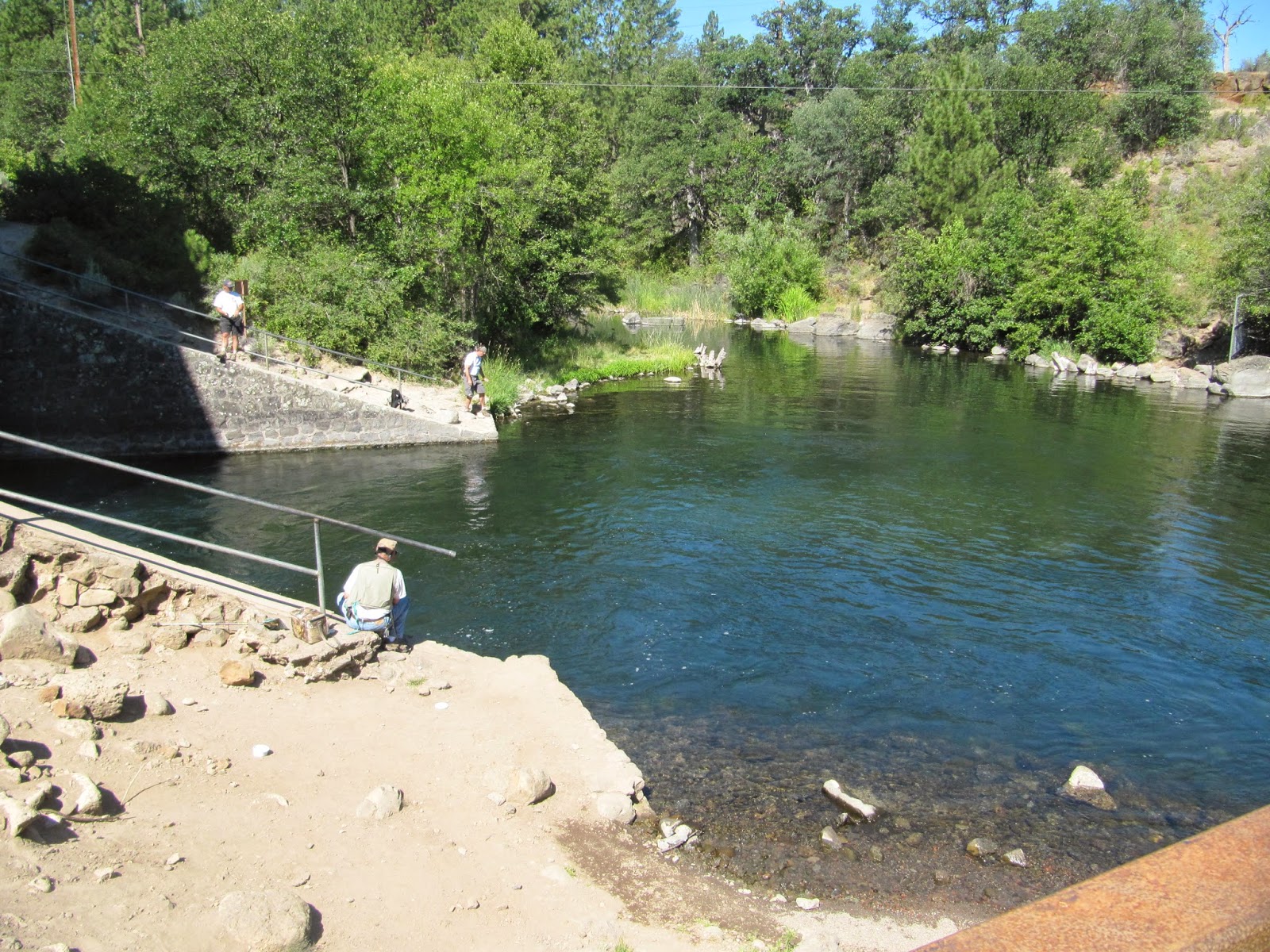
Crystal Lake Hatchery is obviously a great place to fish.

At the Safeway store in Burney Falls, I found Clair recharging her phone.

 Sherpa C was also at the Safeway store.

Now that I've finished my business in Burney Falls, it's time to get back on the trail.